
ArcGIS Companion
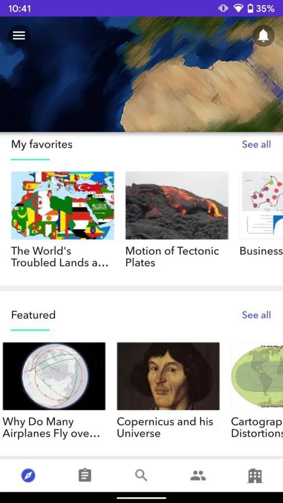
ArcGIS Companion app provides features through which users can complete and manage all the geofencing and field measurement tasks on their mobile. You can tap on the bell icon to view and manage all your notifications. Users can add blogs to a favorite list to read them later.
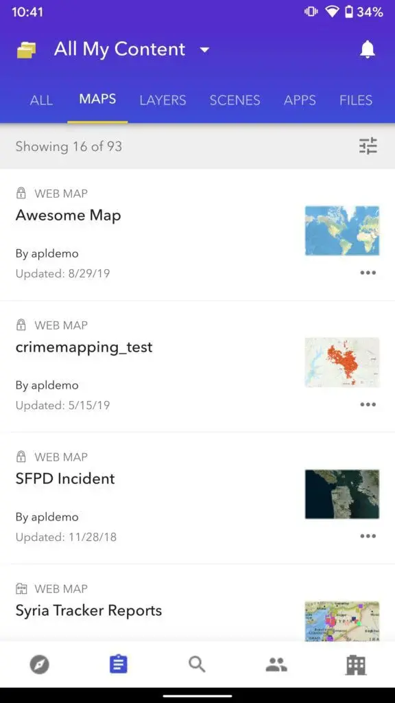
The app offers features that let you manage your field data profile and groups of field measurement data while on the go. Its interface contains buttons to enable users to access the dashboard, content, search, contacts, profile, and settings section. You can view content according to lists such as maps, layers, scenes, apps, and files.
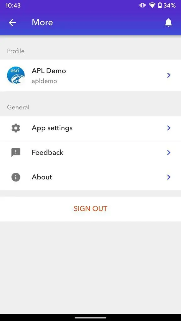
ArcGIS Companion app allows users to learn about their current organization as well as they can also learn about all the members of the organization. You can discover new content on the basis of your interests and can share it with your friends and family members.
ArcGIS Companion Alternatives
#1 GPS Coordinates
GPS Coordinates is an app by Financept that comes up with features to help you in getting the GPS coordinates of your current location. It enables users to tap on the save button to save the address, longitude, and latitude of a location by entering the desired name.
The app provides features through which users can enter their street address to view it in longitude and latitude format as well as can enter the longitude and latitude to see it as the street address. You can also view all the saved locations at a glance.
GPS Coordinates app offers features that let you share your location with friends and family members, or you can save it for later use. Users can also view their location on the map as well as can enter the name of the location on the search bar to view it.
#2 FieldMove Clino

FieldMove Clino app allows users to use their mobile phones as a digital compass to capture their direction data. You can start new field data capture projects, and it shows the project’s name, date of creation, and time of creation in the save section. The app comes up with features to help users perform statistical analysis of field data using stereo net features.
It features a straightforward interface with a side panel that lets you access compass, notes, images, map, and stereo net sections. FieldMove Clino app provides features through which users can export their compass data to view it on Google earth. It shows you the azimuth level in degrees, dip, time of reading, and coordinates. Users can take large measurements to make the field data more accurate, as well as can also take photos of georeferences.
#3 Etta Homes

Etta Homes app offers features that let you communicate with your real estate agent to discover new properties according to your needs. Users can request showing of property by entering the desired date and the time. You can share the property with other users to get advice from them.
Etta Homes – Find your dream home app that provides buttons through which users can access the search, properties, inbox, account, and notifications sections with a single tap. It shows you properties on the basis of your recent property searches, and you can add properties to a favorite list to view them later.
Etta Homes app comes up with features to help users in engaging in a live conversation with a property dealer, buyer, and seller at the same time through a live chat feature. You can send attachments such as images and videos of the properties through messages.
#4 Topography APP

Topography APP enables users to geofence and surveys land by using your mobile phone. The home screen contains buttons through which users can start a new project, can configure geo-fencing or surveying, and can access the settings section. You can tap on an existing project to view altitude, azimuth, velocity, precision, and coordinates.
The app comes up with features to help users in exporting the surveying and geo-fencing reports in a variety of different formats. You only need to enter the name of the project, name of surveyor, municipality, and observation.
Topography APP offers features that let you share data with your office colleagues through various Social media platforms. Users can access the configuration section to view all the devices at a glance and can choose the desired surveying device according to your need as well as can change the unit of measurement.
#5 Avenza Maps
Avenza Maps app provides features through which users can record their GPS location and track during all the field mapping activities. You can enter the name of the desired location on the search bar to search it irrespective of being offline or online.
Avenza Maps – Digital map viewer & map store app offers features that let you measure area and distance between two given points on the map. Users can tap on the navigation section to view direction on a compass, and they can also view the time zone, bearing in degrees, and collapse in degrees.
Avenza Maps – Offline Mapping app allows users to drag and drop marks on the map to add special notes as well as images to remember something important. You can export as well as import all your map data to the mobile phone’s internal storage without much of a stretch.
#6 Map My Field
Map My Field is an app by HarvestYield that comes up with features to help you in measuring the area of all the fields in your farm, but you can save information about a limited number of fields in the free version. Users can also access a built-in calendar to view important dates and can save notes for upcoming dates.
The app is free-to-use, but you can buy make in-app purchases to upgrade to the premium version in order to save information about an unlimited number of fields. Users can save fields by entering the name, name of the crop, area, and type of ownership.
Map My Field app offers features that let you drop pins on the map so you can map and geofence fields. Users can also take a walk around the desired field to measure the area as well as to geofence it.
#7 Mapit GIS

Mapit GIS app allows users to process all the GPS data from GNSS receivers to mobile phones. You can change the type of output stream, format, and stream settings. The input stream section contains buttons to enable users to access the input rover, input base, and correction sections. Mapit GIS – NTRIP Client app comes up with a straightforward interface that contains a side panel through which users can access the server’s status, map, input streams, data processing options, log streams, output streams, and solution options.
You can change the configuration of the input rover by selecting the type, stream settings, format, antenna, and receiver options. Mapit GIS app provides features through which users can access the processing settings section to change the positioning mode, output header frequencies, navigation system, resolution settings, etc. You can select the option to exclude the measurements of all the eclipsing satellites.
#8 OruxMaps GP

OruxMaps GP app offers features that let you connect to the AIS information system to access useful tracks and routes for nautical sports in various arenas. Users can download tracks to navigate to view them while being offline. You can attach images, videos, and audio notes to waypoints. The app provides features through which users can share their current GPS location with friends as well as can also view their location.
You can create new waypoints by selecting the desired icon and editing existing waypoints according to your needs. OruxMaps GP app comes up with features to help users set alarms to receive alerts about nearby waypoints. It allows you to access an extensive collection of waypoints to geofence nautical zones for additional alarms. Users can search for the desired track as well as can also create new nautical tracks.
#9 SW Maps

SW Maps app enables users to record points, lines, polygons, and images to view them on the desired type of map. You can also attach new images, videos, audio clips, and other data to the map. It allows users to save layers as templates to use them again as new layers or can share them with other users to help them.
SW Maps – GIS & Data Collector app comes up with features to help users in adding new points to the map in order to measure the distance as well as the area. SW Maps app offers features that let you select or deselect the options to view recent tracks and images on the route. Users can tap on the plus button to add new points such as the river line, and Bagmati or can choose the option to delete all the existing points.
#10 My Elevation

My Elevation app provides features through which users can get the elevation of their current location from sea level. The side panel enables you to change the view of the map from a variety of different types, including street, satellite, terrain, and hybrid map.
The app offers features that let you add your location to a follow-me list to receive elevation measurements from time to time, according to your location. Users can also tap on the point of interest to view additional information and images of places.
My Elevation app allows users to enter the name of the desired location on the search bar to view the elevation of that location. You can share the elevation of all the locations with other users as well as can bookmark locations to see them later at a glance. Users can enable the night mode to view the map in low light conditions.
#11 GPS Satellites Viewer

GPS Satellites Viewer is an app by S.F Applicality Ltd. that comes up with features to help you in entering your GPS location to view information about all the GNSS satellites above you. Users can also view the altitude of e, n, and z-axis with the accuracy value.
The app provides features through which users can get information about the constellation of the satellite, ID of satellite, and strength of the signal. It shows the total and available number of GPS, GLONASS, GALILEO, and various other satellites in the sky above your current location.
GPS Satellites Viewer app offers features that let you use the camera of your mobile phone to view satellites in augmented reality. Users can change the measuring units from the side panel as well as can change the satellite view. You can tap on the position view to take a look at satellites.
#12 Geodesist

Geodesist app allows users to perform geodetic calculations ranging from basic to advanced levels. You can also receive all the data about your location, such as longitude, latitude, source, time zone, direction, speed, and accuracy, etc. Users can also save coordinates to calculate data, and view coordinates in all projections.
The app comes up with an extensive collection of more than six different coordinates systems to help users in viewing the coordinates according to their needs. You can track satellites to view information, including elevation, the ratio of signals, PRN, azimuth, and ratio of noise, etc.
Geodesist app provides features through which users can view all the coordinates system in 3 different projections, including geodetic projection, Gauss-Kruger projection, and geocentric projection. You can also convert coordinates into all the projects and can calculate the azimuth as well as elevation of the sun.
#13 Mobile Topographer Pro

Mobile Topographer Pro app comes up with features to help you mark properties on the map with greater accuracy. Users can create lists of points to add them to groups for easy accessibility and filter the list of points based on names without much of a stretch. The app provides features through which users can export all the field surveys and property marking data in various formats.
You can tap on the desired location on the map to complete the survey without stepping into the field and adding or deleting points. Mobile Topographer Pro app offers features that let you collect data about the terrain to create a 3D model of the terrain. Users can create 3D terrain models to use later and export them to use on other smart devices.
#14 Orienteering Compass & Map
Orienteering Compass & Map is an app by Calmatics that allows users to find direction and measure the distance from your location. You can tap on the line button to put a line on the map to measure distance using a straight in metric units such as meters and kilometers.
The app comes up with a built-in compass to help you in finding your correct direction so you can travel in the right direction. Users can rotate the map to line up with your current position right through your fingertips. It shows the east and north coordinates of your position on the map with information about your direction in degrees.
Orienteering Compass & Map app provides features through which users can tap on the layer button to change the style of the map from selecting a variety of different layers such as satellite maps, street maps, and topographic maps, etc.
#15 Survey Master

Survey Master app offers features that let you complete topo and auto surveys right on your mobile phones. It allows users to download projects available on the cloud server with a single tap. You can edit details about lines, points, and polygons to change the icon’s name, code, colour, and style. The app provides users with a straightforward interface that contains buttons to access projects, datum, elements, code, BaseMap, import, export, features, cloud, and settings sections.
Survey Master app comes up with features to help users export all the survey data to the mobile phone’s internal storage. Moreover, they can also create a backup of the data on a cloud server to access it later and view it on all your other smart devices. You can connect your mobile device with GNSS receivers.
#16 WikiCamps Canada

WikiCamps Canada is a digital mapping app that enables users to plan their camping adventures so they can easily find a location to camp in the wild. You can plan road trips by adding sites to the trip as well as can share progress with others.
WikiCamps Canada – Find campgrounds, and RV parks app is a free-to-use trialware app, but you need to make in-app purchases to upgrade to the full version. It offers features to help users in accessing a variety of different camping sites on the basis of their location.
WikiCamps Canada app offers features that let you access the details about all the camping sites such as offers of sites including shower, water, power, toilet, and pet friendly, etc. Users can add camping sites to a favorite list to receive notification alerts about the place and can synchronize the data on all other devices.
#17 CartoDruid

CartoDruid app provides features through which users can edit information about georeferencing without much of a stretch. You can also drop points on the map in a straight line to measure the distance in meters. Users can export the map data to use it later and can import it with a single tap.
CartoDruid – GIS offline tool app offers features that let you create new layers of maps according to your needs as well as you can also configure existing vertical layers to determine the accurate geometrics on the basis of attributes.
CartoDruid app allows users to add a large number of points on the map to measure area and distance in hectors or acres units. You can tap on the plus button to zoom in to the map or can tap on the minus button to zoom out, and it shows the current zoom level on the bottom.
#18 PRO Landscape Home

PRO Landscape Home is an app by Drafix Software that comes up with features to help you in designing the garden of your home by taking an image of your home using your phone’s camera. Users can access a built-in toolbar view all the recently and frequently used commands at a glance.
The app provides features through which users can share images of landscapes with friends and family members through various social media platforms to get advice from them. You can also save the design to start editing from where you left and can compare edited and simple versions of the image.
PRO Landscape Home app offers features that let you select icons of a variety of different objects, including trees, shrubs, flowers, water, fireplaces, rocks, edibles, and many others. Users can change the size of the object according to their needs.
#19 Coordinate Master

Coordinate Master app allows users to convert given coordinates into a variety of different formats such as the world’s coordinate system, geoid system, and geocentric system, etc. You can create new coordinates by entering the parameters of the location.
The app comes up with features to help users in entering the coordinates of a location to view the time zone and distance from the north as well as south poles. You can copy the data to use it directly or can tap on the save button to save the reading for later use.
Coordinate Master app provides features through which users can also calculate the magnetic field by entering the longitude, latitude, altitude, date, the format of output, and intensity. You can save projects by selecting categories and members. Users can find information about the angle of the sun, such as latitude, longitude, declination, and azimuth, etc.
#20 Canopeo

Canopeo app offers features that let you get the percentage of the quantity of all the green crops on your farm by taking images through the mobile phone’s camera. Users can also view details about each crop, including, name of the crop, height, field number, plantation date, important notes, and percentage of the quantity of crop, etc.
The app provides features through which you can keep an eye on the progress of all crops to make the right management decisions. Users can also record geographic coordinates, date, and time with each reading.
Canopeo app comes up with features to help you in measuring the damage to the crops due to various weather conditions such as freeze, hail storm, or herbicide, etc. Users can write notes with images to remember essential details as well as can share the gathered information with experts to get useful advice.
#21 BackCountry Navigator TOPO GPS PRO
BackCountry Navigator TOPO GPS PRO app enables users to download Offroad topo maps on their smart devices so they can use them as handheld GPS devices to navigate between the wild during their trips.
The app comes up with features to help users in creating their personal camping maps with a built map creator and can upload it to a cloud server to help other users in enjoying their trips. You can also access an extensive collection of a large number of raster marine charts to enjoy kayaking and other water adventures.
BackCountry Navigator TOPO GPS PRO app offers features that let you create a list of all the waypoints, and you can sort lists on the basis of name, distance, or date of creation to take a look at them as well as can enter the name on the search bar to search for the desired waypoint.
#22 Wikiloc Outdoor Navigation GPS

Wikiloc Outdoor Navigation GPS is an application that enables users to track their hiking or other activities with GPS, and users can navigate different trails provided by the app worldwide. The application allows users to find the ideal trail depending on its length, height, and other interest for their next hiking journey.
The app enables users to track and record their outdoor activities on a map, and they can get real-time statistics such as speed, distance, and they can take and store photos along their route. Moreover, it also allows users to discover the best trails around their location.
Wikiloc Outdoor Navigation GPS requires no internet, and users can save the map and directions before going on hiking. Lastly, it also allows users to enable other people to see their location through its live tracking feature, and users can add people who are going on with them on the trail.