
MapJam
MapJam is a platform that allows users and businesses to create and publish useful and personalized maps. It allows the users and businesses to add valuable context to maps such as instructions conveyed through email or phone that can be communicated through these maps easily.
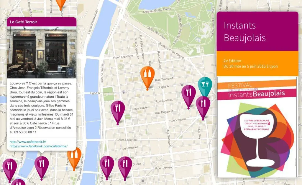
The platform also allows the users to assign a unique code or name to locations and can be shared simply by those one-word codes. These codes are simple and can be shared via SMS, radio, phone, or email. Moreover, users can map parks, libraries, and other essential places on these maps for other people.
MapJam uses a drag and drops feature to create, customize, and personalize maps with content and context. Moreover, all these maps can be embedded and hosted online on websites and social media platforms. Lastly, the visitors on maps created by this platform only show those places that are added by the map creator.

MapJam Alternatives
#1 Bing Maps
Bing Maps is also known as Windows Live Maps, is the mapping service being offered by Microsoft. This mapping service can be directly accessed from the Bing search engine as well. It provides users with aerial images and mapping services along with road maps. Its main features are street maps, road view, aerial view, bird’s eye view, street side, venue maps, 3D maps, and many other maps and navigation services.
It offers its mapping and live navigation services in almost all major cities and locations across the globe. Its bird’s eye view mapping service is not available for every country. There is also an application of Bing Maps that displays the road data by using the OpenStreetMap.
#2 Apple Maps
Apple Maps is the default mapping service for Apple devices. It provides a 3D mapping and navigation service for driving, walking, and other traveling purposes. The best thing about it is that it provides live 3D models of structures and buildings for Apple devices. The other thing good about it is that it uses vector graphics to provide maps of locations and places.
It provides the users with four basic layers: regular map, satellite view, hybrid view, and the transit system for public transportation. Instead of utilizing an independent navigation system for mapping and navigation, it heavily relies on the third-party mapping service. Its mapping service can be used to planning routes and getting turn by turn navigation with spoken instructions for public transportation, pedestrians, and vehicles.
#3 Yandex.Maps
Yandex.Maps is a free mapping service for finding the addresses and companies across the globe in the shape of maps. The users are only required to insert the place or organization name and get the step-by-step route to the address. There is also a system for getting live traffic situations and its live traffic navigation system to assist the drivers in planning for their routes in case of a traffic jam or an accident on their route. It also provides the user with a nearby alternate route as well.
Those who want to get the addresses of the favorite places can also get them from this platform by simply clicking on the place options, just like other mapping services Yandex.Maps also offer its users to measure the distance between two locations as well. They can also get to the street panoramic views and provide maps, information on streets, organizations, house numbers, and photos of buildings. The drivers can also use Yandex.Maps to know about the traffic situation on a specific route.
#4 Yahoo Maps

Yahoo Maps is among the world’s best maps service providers that provide maps, driving directions, and traffic positions on a road. It is a free mapping service being provided by Yahoo. The core areas covered by these maps are address book, live traffic, point of interest finder, driving directions, draggable maps, multi-point driving directions, find on the map, etc. Its main services are an address book system, live traffic, point of interest finder, and driving instructions.
The address book system of Yahoo Maps enables the users to easily search for the business addresses and store them in the address book for future review. Its live traffic system can be used for knowing about the current conditions on a specific route. The driving direction system is for getting the turn by turn maps or instructions in the shape of the text. The street maps and driving navigation system of Yahoo Maps are only available for Canada and United States.
#5 HERE Maps

HERE Maps is the mapping service that was first launched for smartphones only but now available for desktop systems. It is a new name of OVI Maps, Nokia Maps, and NAVTEQ Apps. It shows the places of over 200 countries. Moreover, its services can be used from Android, iOS, Windows Phone, Firefox OS, Fire OS, Ubuntu Touch, and Sailfish OS. This platform includes unique features like driving and walking turn-by-turn, live traffic rerouting/visualization, social networking service integration, and many more. The three main features of your maps are offline maps, venue maps, and street views.
The offline maps service allows the users to download the maps of countries and save them permanently to search for places and plan the routes in the offline system without using the mobile data. Then there is the venue maps system that is basically used for knowing about the airports, shopping malls, and public places in a specific area or country. The users can also get the step-by-step navigation in three dimensions as well. Its other features are turn-by-turn navigation, public transport direction system, pedestrian navigation system, real-time traffic information, a system for reversible lane traffic, and sharing of location with others.
#6 MapQuest

MapQuest is especially for drivers that show the maps of roads, routes, and streets. Via using this online map service, the user can see local traffic and road conditions can find nearby business places, restaurants, public places, hotels, hospitals, and many more. Use MapQuest and get live maps, GPS, voice navigation, and live traffics updates for free.
The other features of MapQuest are: choose from up to three different driving routes, bookmark home and work addresses, instantly search nearby locations & places, etc. The two primary mapping and navigation categories in MapQuest find places and get directions. Find sites option is for directly finding the address and path of any popular place.
The get directions system of MapQuest is for knowing about the step by step address of any location from the current position of the users or the other that the users provide. The best about MapQuest is that there is a shortcut system of finding of the favorite places in your desired area as well that are in the shape of a coffee shop, parking, bars, food, filling station, hotels, postal service and a lot of others. The mapping and navigation service of MapQuest is also available in the shape of apps for smartphones as well.
#7 2GIS

2GIS is a local map and navigation service provider for the areas and locations of the United Arab Emirates only. It is not as much detailed as compared to the other mapping service providers because of its restriction to some specific areas only. 2GIS is only for UAE residents and for those who are planning for a trip to the UAE. 2GIS provides a map of Dubai, Sharjah, and Ajman.
The Willing user can find the addresses of eating out, hotels, pharmacies, ATMs, and many other popular categories. Its app is available for Android, iOS, and Windows Phone. 2GIS provides 3D maps of over 180+ cities and contacts of over 1.5 million companies, care routing, and public transport routes, and many more.
The process of using 2GIS is straightforward, where users are only required to provide the company name, address, or route information. In reply, they will get the detail of the information provided. You can also get the direction of two routes as well. 2GIS is one of the best mapping services but with the limitations of using in the UAE territory only.
#8 OpenStreetMap
OpenStreetMap is basically a map provider and map creator that provides the maps of the major locations across the globe and provides the users with the system of editing these maps. It is, in fact, the map of the world that multiple people under an open license have created. It uses a topological data structure with four core elements: nodes, ways, relations, and tags. The OSM data primitives are stored and processed in various formats. The data available can be used for both traditional applications that’s make it different from other map services.
It features information about the local roads, railway stations, cafes, coffee shops, and much more that are available in the shape of aerial imagery and can be accessed from almost all those devices that use the internet connection or support the GPS. The best about OpenStreetMap is that it provides the users with accurate and up-to-date maps and information. However, one problem is associated with it: the non-availability of the live traffic navigation system.
#9 WikiMapia Map

WikiMapia Map or simply WikiMapia lets the users search for the millions of places in the directory, and it is a mapping service introduced by Wikipedia. It is based on the open-content collaboration system, which means anyone can participate in the mapping service. The users can edit these maps and directions as well. Currently, it has covered almost all places across the globe.
There is no live traffic and navigation system, so don’t bother to use it for that purpose. However, if you want to get any specific area’s direction, you can easily go for it. The best about WikiMapia Map is that it supports various international languages. So, the users can get information regarding any map in their own language.
#10 Waze Map

Waze Map is a community-based mapping and navigation service that is available in web-based services and applications for smartphones. It is basically a user-contributed mapping and Live traffic navigation service where the people and drivers help each other provide real-time information about a specific route. There is also a proper live maps service that the community map editors update in real-time.
The best about Waze Map is that it provides users with real-time situations on any road and informs them of traffic jams, accidents, police traps, and much more. In case of a problem on a specific road, it provides the users with information on alternate routes. It also deals with the voice-guided navigation system that makes it easy for the users to focus on the voice and get the direction instead of viewing the screen all the time. The users can contribute here by simply providing the address, destination, and information about the road data they are currently traveling.
#11 Navmii

Navmii is a free navigation and traffic app for drivers that is available to use on Android and iOS devices, and you can download and use it anywhere around the world. It combines free voice-guided navigation, live traffic information, local search, points of interest and driver scores, etc.
Offline maps stored locally for use without an internet connection. More than 40 million drivers around the world use this, and its maps are available from up to 150 countries. Navmii features on-board OpenStreetMap that are stored on your mobile device, and therefore you don’t need an internet connection.
It is a simple and easy-to-use app that does not require registration or personal information. Navmii Navigation app includes core features such as real-time traffic and road information, offline and online address search, drive scoring, local place search, fast routing automatic rerouting, and search using postcode, etc.
#12 Google My Maps
Google My Maps is a top-rated application that allows you to monitor important places, create customized maps to ease in remembering places close to your heart, plan the next trip, and discover new cities directly from the mobile phone. The best feature is that it puts all the maps in a single location, and they can be edited or modified without hassle. You can use it to visit all the famous places with friends in the city and make them acquainted with all the attractions.
All that you need to do is create a map containing places that you plan on visiting and then begin the journey. Besides this, it is also possible to collaborate with others to come up with wonderful maps. Lastly, all the maps can be customized according to requirements and can be accessed from anywhere and anytime.
#13 BlackBerry Maps
BlackBerry Maps is a high-performance, multitasking mobile application that provides you with highly customizable and fully-featured maps, geocoding, traffic, walking and transit directions, point of interest information, integrated business data, 3D buildings, indoor maps, weather, and more. The browsing experience is great on this app, as well as easy navigation with extremely fast page load times and a fully zoomable interface makes it an all-in-one map application. You get a tremendous depth of map data, including HD mapping with hundreds of map layers on an area.
Features include interactive driving directions and points of interest information, Ease of development, streamlined APIs for the most common platform, Easy customization, many predefined options for building custom interfaces, and Graphical representation of web content are availabe. Easily zoom in or zoom out with fast map rendering, turn by turn directions, share map areas, and see every location with your Blackberry phone. All in all, BlackBerry Maps is a great tool that you can consider among its alternatives.
#14 Quikmaps

Quikmaps is a tool that allows you to make a replica to create your own personalized map. You can use this tool in a variety of industries like market intelligence, trend analysis, breaking news, and much more. It gathers data from multiple satellites, give you a satellite as well as terrain view with the option to on and off certain features like topography, building, roads, etc.
This mapping framework has potential applications other than the GPS systems and also holds implications for developing a future infrastructure of global satellite navigation systems. You get an interactive whiteboard to mark out the things you like directly on the map. Zoom in to the area and explore things like parks, houses, or any area. All in all, Quikmaps is a great tool that you can consider among its alternatives.
#15 Scout by Telenav

Scout by Telenav is a real-time, location-based social networking app for sharing places with friends. It enables you to meet up with friends and exchange travel information at any given time. To accomplish this, Scout uses both personal social data and their own proprietary map of metropolitan areas to present information. In addition, it incorporates crowd-sourced check-ins and activity streams into its core functions. A great feature of this app is the ETA (Estimated Time of Arrival), which lets you pick up your route from where you are coming and share the arrival time with others.
You can see others’ real-time locations and ETA for better coordination. Message and voice chat functionalities are also available to communicate in case of any emergency or late arrival time due to traffic. It uses real-time GPS and info to see which route is crowded and which is free to redirect you from there. All in all, Scout by Telenav is a great tool that you can consider among its alternatives.
#16 Printmaps.net

Printmaps.net provides maps for web applications such as print layout editors, application for sale listings, geospatial navigation, and teaching spatial data analysis. A database is constructed to include large amounts of topographical information of a region, along with corresponding demographic and population information.
Maps can be browsed through this database by administrative region or street name. Zoomable maps are available with customized layouts, controls, roadways with restrictions such as highway construction or low clearance areas. There is also a mobile version that displays the same information on a touch screen mobile device.
In addition, the website provides an easy way to make PDF files with embedded maps from the website’s online map editor. Other than PDFs, you also get files in PNG or PSD with all the separate layers to edit them in Photoshop. Choose the options to activate them in the web tool such as wood, land use, building, grass, park, and contour lines. All in all, Printmaps.net is a great tool that you can consider among its alternatives.
#17 YourMapp

YourMapp is a web-based tool that enables software developers to create customized mapping applications by means of HTML5 and JavaScript without the need to learn or utilize another scripting language. It does this by combining different elements of current mapping and navigation technology, as well as the built-in tools in common web browsers. As a result, YourMapp can be integrated into websites and mobile apps with very little work and time involved.
It can also be used in non-technical environments, such as on social networking sites, so long as there is access to a map on the website. The primary application for YourMapp is the ability to customize web-based maps for special purposes. Examples include commercial sites that provide tailored travel routes to users or touristic information about locations of interest. However, it can also be used for fun purposes, such as when designing customized electronic board games or computer-generated scenarios. All in all, YourMapp is a great tool that you can consider among its alternatives.
#18 Google Maps
Google Maps is a free mapping and navigation service by Google. It provides global satellite images, and street maps, and panoramic streets view as well. It is also used for live traffic as well. In addition to providing simple mapping and traffic navigation services, it is also used for route planning for traveling either by foot, vehicle, or public transportation. The best thing about it is that it provides users with the system of embedding Google Maps in their blogs or websites.
Its free service can be used for finding the addresses of local businesses and other organizations. There is also a contribution system named Google Maps Maker that allows expanding and sharing its mapping service. Currently, it is offering its mapping and navigation services for almost all cities and locations across the globe. It is also available in the form of desktop applications and for smartphones as well.
#19 uMap

uMap is an open-source, easy-to-use platform that enables you to create and embed maps in your website with great ease. The maps and layers can be created using OpenStreetMap, after which they can be added to the site. The features include sharing and embedding the map, selecting the license, choosing the map layers, and more. You can begin by opening the website on your browser and then clicking on the “Create a map” button. It will lead you to the map creation screen, and from here, you can use the various tools to finalize a map.
#20 Mapme

Mapme is a powerful and feature-rich map builder that allows you to create stunning and interactive maps without much effort and difficulty. You can access many of its tools to create filters and categories, add locations using PDFs, photos, and videos, have 3D buildings appear on the maps, and many more. It provides rich content with which you can populate the maps with 3D tours, photos, PDFs, and videos. You can make it easy for users to filter through the map by applying categories and filters to the map.
The best feature is that it enables everyone to import locations using spreadsheets. The solution includes various drawing tools to enable you to draw shapes and lines or reduce the effort by importing KML or GPX files. There are also many other characteristics provided by Mapme, such as Custom markers, Flexible Layout, Custom map styles, 3D buildings, Reporting, Embed, Print, and Get Social. The tool is reliable and is currently serving many customers operating in different industries like Tourism and Hospitality, Nonprofit and Government, In-person and Virtual Events, Commercial and Residential Real Estate.
#21 MapHub

MapHub provides you with the tools you need to create your very own interactive maps and share them with others. Maps can be created alone or by collaborating with other people. Any map can be easily displayed on your website by embedding it there. The map creation process involves adding labels, points, polygons, or lines. You can even add the desired photos and maintain a structure by organizing items into groups.
The solution also supports the export/import of data in CSV, GeoJSON, GPX, Shapefile, or KML formats. Teams can work together on maps by collaborating via the internet. The access can be controlled, and you can decide who can see and edit the map. The best feature is that it can restore previous versions of maps from the past 30 days. MapHub is free from ads and doesn’t deploy cookies to monitor the activity of users.
#22 TravelMap

TravelMap is a multi-featured tool that enables you to create a travel blog without paying any fees. It is developed to bring ease to the life of Travellers and empower them to share their whereabouts and the places they are about to visit. You can plan your itinerary and map the routes that you want to undertake. The best feature is that travel bloggers can share their trips and enhance the experience of the viewer by connecting photos to various spots on the map.
It provides a travel journal to help everyone record their trips and everything that transpired during that time, making it easy to read later on. The TravelMap can be easily embedded on the website via the official WordPress plugin. You can manage the Travel Blog by utilizing the dashboard with a simple and beautiful design, requiring no technical knowledge. It also removes any problems associated with Content Management by enabling you to add content via the desired device such as Tablet, PC, or Smartphone.
#23 PlanePlotter

PlanePlotter is an online platform that receives and decodes live digital data of plans and prints it in the form of a chart. The platform comes with a number of features, such as a message display box where all the messages related to decoding are displayed.
It archives all the data which is received on the platform and which users have decoded so far. The chart which the platform presents contains the position, altitude, and decoded time of the message. Users can add different reports in the chart, such as AMDAR report, and others.
It allows users to use the Google Earth interface, which enables users to displat#y a plane position according to it. PlanePlotter comes with an alert system that sends alerts when a specified registration flight number is detected. Lastly, it can send audio messages to its other stations and can share messages with the other stations.
#24 FATMAP

FATMAP is one of the best applications for mountain sports and adventures that enable the users to select different types of adventures and their locations directly through the app. Users can simply search mountain adventures and the route to those adventures right from the app. Moreover, it helps the users to discover the best routes for skiing, hiking, etc. with complete guides.
The application enables the users to plan and navigate like a local of that area, and it provides a 3D map. Users can locate themselves easily on the map at any time and can share their location with others.
Users can view the real-time weather condition such as snowfall and snow depth levels. Users can check which resorts are open and what they are offering from the app. Lastly, it enables the users to download any part of the map, and they can use it without the internet connection.
#25 FindShip

FindShip is an application that enables users to track ships of all kinds all over the world in the sea. It allows the users to track the movement of vessels in real-time on the map and can see its exact location. The application covers most ports and seas of the world and can show up to more than one hundred thousand ships and vessels online to the users.
The application enables the users to manage their fleets and provides different kinds of information about the ships, such as owner and manager name, photos of the ship, AIS information, and much more. It offers an ETA calculator to assist the sailors in navigation.
FindShip enables the users to check the port’s weather forecasts and also provides typhoon updates and monitoring features. Users can also share their ship’s information with their friends. Lastly, it offers a free trial and a paid membership.
#26 Leaflet

Leaflet is a reputable and leading JavaScript Library that allows you to build web mapping applications that are light in weight. The software surfaces all the agile tools in the bank that provides you the professional mapping of applications. Leaflet is facilitating developers with the functions which they required the most, and its structure is designed appropriately, and usability and performance are the main concerns of Leaflet.
The software comes with an intuitive interface that is easy to use and consists of a single page that used to circulate in large numbers and support both desktop and mobile platforms. The software is dispensing multiple features that follow out of the box layers, robust customization, complete browser support, dynamic visuals, and more to add. Leaflet is providing you a chance to create the best mapping library in no time with a versatile range of features and control that is cost-effective and saves developing time as well.
#27 StepMap

StepMap is an online tool for building and displaying maps, built using JavaScript, SVG, and Google Maps API. You can build your own maps with this tool by entering a desired geographic region, heightmap, custom iconography, data layer and type, styling and colors, popups, labels, or legends. StepMap allows you to generate static or interactive maps with easy drag-and-drop actions. You can generate visualizations that can be shared on the web or exported as HTML5 vector graphics for printing.
The tool could be used to visualize regional stats levels in countries much more efficiently. A great benefit is that the easy UI lets you create maps without any technical knowledge. After you have created the map, you can save it into a high-resolution format to print on large posters. All in all, StepMap is a great tool that you can consider among its alternatives.