
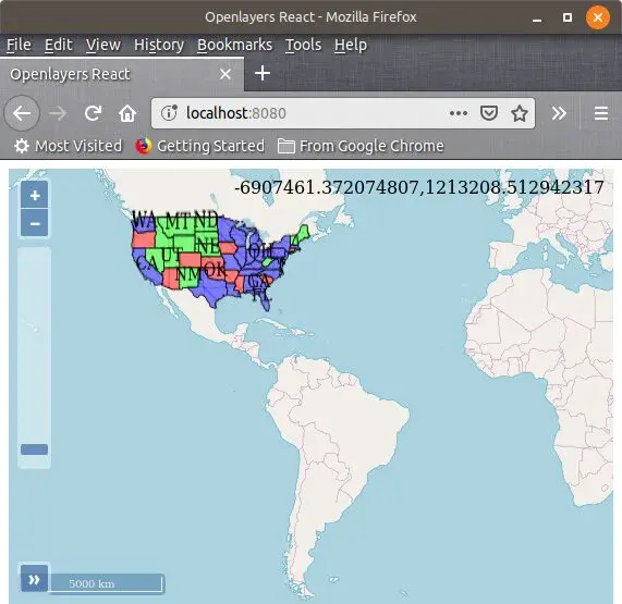
OpenLayers
OpenLayers is open-source software that comes with the JavaScript library, which is used to display map data on web pages. This software is a completely versatile way to put your map and is capable enough to display map tiles, vector data, and makers that are loaded from any source.
There is also a possibility to use the geographic information of all kinds courtesy of newly developed OpenLayers. OpenLayers is completely free to use and based on JavaScript sand, and you have effortless styling for your map controlling having CSS. Take a look at multiple features that are different levels of API, cutting-edge support, canvas 2D, WebGL support, out-of-the-box mobile support, tiled layers, quick start, and much more.
OpenLayers Alternatives
#1 OpenStreetMap
OpenStreetMap is basically a map provider and map creator that provides the maps of the major locations across the globe and provides the users with the system of editing these maps. It is, in fact, the map of the world that multiple people under an open license have created. It uses a topological data structure with four core elements: nodes, ways, relations, and tags. The OSM data primitives are stored and processed in various formats. The data available can be used for both traditional applications that’s make it different from other map services.
It features information about the local roads, railway stations, cafes, coffee shops, and much more that are available in the shape of aerial imagery and can be accessed from almost all those devices that use the internet connection or support the GPS. The best about OpenStreetMap is that it provides the users with accurate and up-to-date maps and information. However, one problem is associated with it: the non-availability of the live traffic navigation system.
#2 Google Maps
Google Maps is a free mapping and navigation service by Google. It provides global satellite images, and street maps, and panoramic streets view as well. It is also used for live traffic as well. In addition to providing simple mapping and traffic navigation services, it is also used for route planning for traveling either by foot, vehicle, or public transportation. The best thing about it is that it provides users with the system of embedding Google Maps in their blogs or websites.
Its free service can be used for finding the addresses of local businesses and other organizations. There is also a contribution system named Google Maps Maker that allows expanding and sharing its mapping service. Currently, it is offering its mapping and navigation services for almost all cities and locations across the globe. It is also available in the form of desktop applications and for smartphones as well.
#3 Leaflet

Leaflet is a reputable and leading JavaScript Library that allows you to build web mapping applications that are light in weight. The software surfaces all the agile tools in the bank that provides you the professional mapping of applications. Leaflet is facilitating developers with the functions which they required the most, and its structure is designed appropriately, and usability and performance are the main concerns of Leaflet.
The software comes with an intuitive interface that is easy to use and consists of a single page that used to circulate in large numbers and support both desktop and mobile platforms. The software is dispensing multiple features that follow out of the box layers, robust customization, complete browser support, dynamic visuals, and more to add. Leaflet is providing you a chance to create the best mapping library in no time with a versatile range of features and control that is cost-effective and saves developing time as well.
#4 MapTiler

MapTiler is a top-notch mapping platform that comes with the strategic way to publish zoom-able maps online either for web applications, mobile devices, and 3D visualizations. There are multiple customizations you can make, like switching language, change colors, and select fonts. This platform utility is the way to go with its support for privacy, online interacting maps, fast map processing, maps on-premise, privacy for users, visual geo-referencing, geo host data, and more.
Whether you are looking for maps for transportation, weather visualization, agricultural analysis, or earth observation data processing, you can build your own. High-speed loading, interactive datasets, pre-generated tiles, and freedom of hosting are the few top features that make MapTiler a good choice as far as your developing and hosting experience are concerned.
#5 Alta4

Alta4 is a web-based GIS software and service that has been successful with its advanced IT solutions. The platform provides businesses with multiple ways to increase productivity by working on collaboration and bringing innovative product implementation tailored to the needs of the users. You have fast photo documentation that is secure too, and you have all the data in place to map faster. Apart from the mapping, you have geo-marketing, geo analysis, and routing service as well.
Alta4 is the name of success when it comes to HTML mapping and has been over the years providing the software solution for ArcGIS server that allows you to make customization and create an online map for sure easily. The platform maintains all of your needs to run your online map service at a low cost, and more likely, you can find many integrated solutions here.
#6 Mapbox
Mapbox is mapping software that comes with the integrations, location search, navigation support into any mobile and web application. The software facilitates the developers with the tools that allow them to change the meaning of navigation via designing maps and location-based applications. Get an extra advantage of the extended APIs, SDKs, and more likely, you have a live-updating map that allows you to build better mapping, navigation, and reliable search experience across multiple platforms.
The software comes with the studio that is kind of a photo-shop for the maps giving control to have rich colors, fonts, 3D features, and right angles of the camera. Talking about extensive features that include powerful routing engines, turn-by-turn directions, AI-Powered semantic segmentation, detect things on the road, display driver assistance alerts, create custom map styles, and more to add. Furthermore, Mapbox brings data from the thousands of sources, and the maps that you have designed are then can be used for empowering on-premises applications running GL JS, and now you can navigate SDK for android and IOS.
#7 Pix4Dmapper

Pix4Dmapper is a leading photogrammetry software that is used for professional drone mapping purposes. The platform capture the RGB, thermal and multispectral images with any camera, and users can use it to digitize the images in digital maps and 3D models with it. Moreover, it enables users to process projects with the software on the online process.
The platform offers control to users to assess, control, and improve the quality of their projects. It enables users to use quality reports to examine the generated results, details, and other quality indicators in the project. Users can accurately measure distances, areas, and volumes. Pix4Dmapper enables users to collaborate in the projects with the streamline project communication and teamwork.
Pix4Dmapper allows users to share project data and insights with the team selectively, and users can use standard file formats. Moreover, it offers survey-grade results to the users to help them get things easily and clearly. Lastly, users can use the default templates to process their projects, and they can change the settings accordingly.
#8 WebODM

WebODM is a drone mapping software that allows users to generate maps, point clouds, DEM, and 3D models from aerial images. Users can also run the software on the computer, and they can also use offline without any difficulty. Moreover, it comes with orthomosaics, which helps in georeferencing and allows users to create orthorectified maps. Users can also use its elevation models for georeferenced digital elevation models, and they can get 3D models in OBJ format.
The platform allows users to take measurements with ease, and they can track the stockpiles through the software. Moreover, it also offers such features that users can easily compute plants’ health, such as VARI, NDVI, GNDVI, and many other indexes. The software helps users to create and use Ground Control Points for additional accuracy.
WebODM comes with contours that help users to preview and export elevation contours to AutoCAD or GeoPackage. Users can use any camera from general phone to professional cameras and use any format for the pictures, such as JPGs or TIFFs.